Waterbodies are not static. Sediment accumulates, channels migrate, reservoir capacity changes, and underwater infrastructure is exposed to evolving bed conditions. Hydrographic surveying replaces assumptions with measured depth, geometry, and change over time.
Sequoia Advanced Systems deploys Argus 1.0 for hydrographic and bathymetric survey work across California reservoirs, lakes, rivers, canals, and managed waterways. Dual-frequency sonar, GPS-defined survey lines, and shore-based operation support sediment volume calculations, pre-dredge and post-dredge baselines, reservoir capacity studies, and repeatable change detection.
Our autonomous surface vessels help hydrographers, engineering consultants, dredging contractors, and water-resource teams collect dense, documented survey data in shallow, hazardous, or difficult-to-access water while keeping experienced professionals in control of survey design, calibration, quality assurance, and interpretation.
Reliable bathymetry supports capital planning, contractor payment, regulatory documentation, asset management, and the prioritization of future fieldwork. Four themes recur across the work.
Reservoirs and ponds lose usable storage as sediment fills them. Bathymetric survey quantifies that loss, supporting water-supply planning, dredging decisions, and the long-term management of a critical asset.
Dredging projects are planned, paid, and disputed on volume. Accurate pre-dredge baselines and post-dredge verification turn a costly guessing game into a documented quantity that holds up under review.
Hydraulic and sediment-transport models are only as good as the geometry beneath them. Channel and reservoir bathymetry feeds flood modeling and informs watershed management across a basin.
Bathymetry around dams, spillways, bridge piers, and intakes supports scour assessment and asset management, while navigable-depth surveys keep channels, harbors, and boat ramps safe and usable.
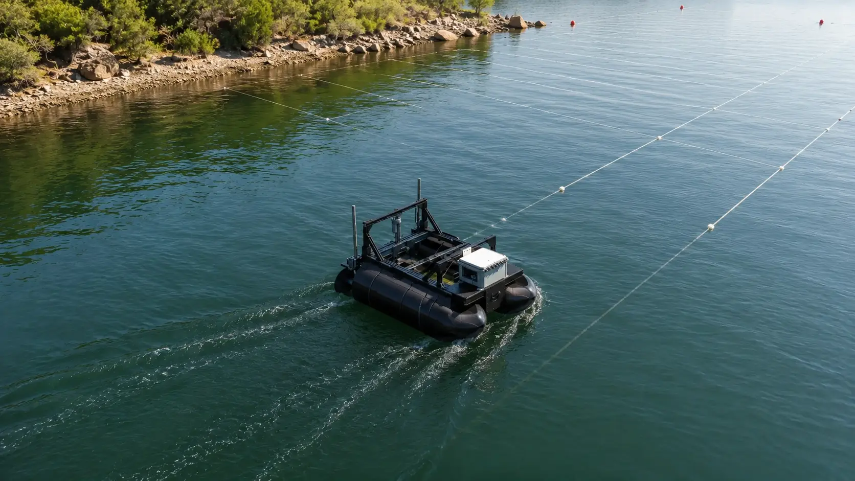
Preprogrammed survey lines maintain planned spacing and route geometry across the site. Consistent line-keeping improves sounding density, reduces coverage gaps, and creates a repeatable basis for future surveys.
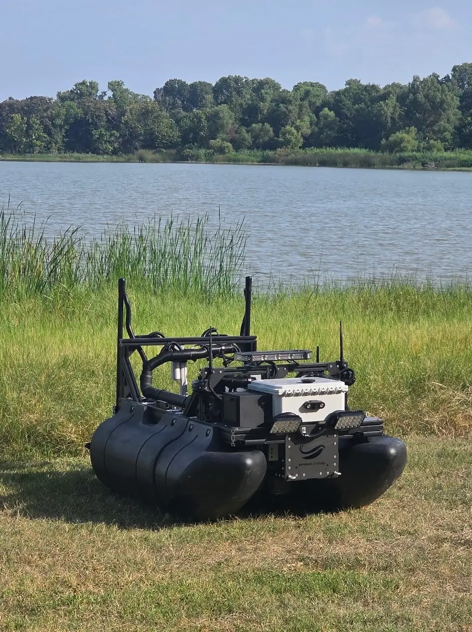
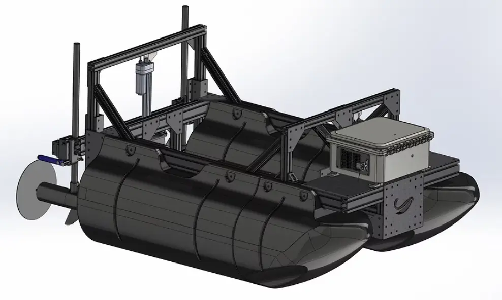
Shore-launchable, low-draft platforms reach reservoir margins, canals, ponds, and hazardous areas near infrastructure without requiring a conventional launch ramp or placing a crew aboard the vessel.
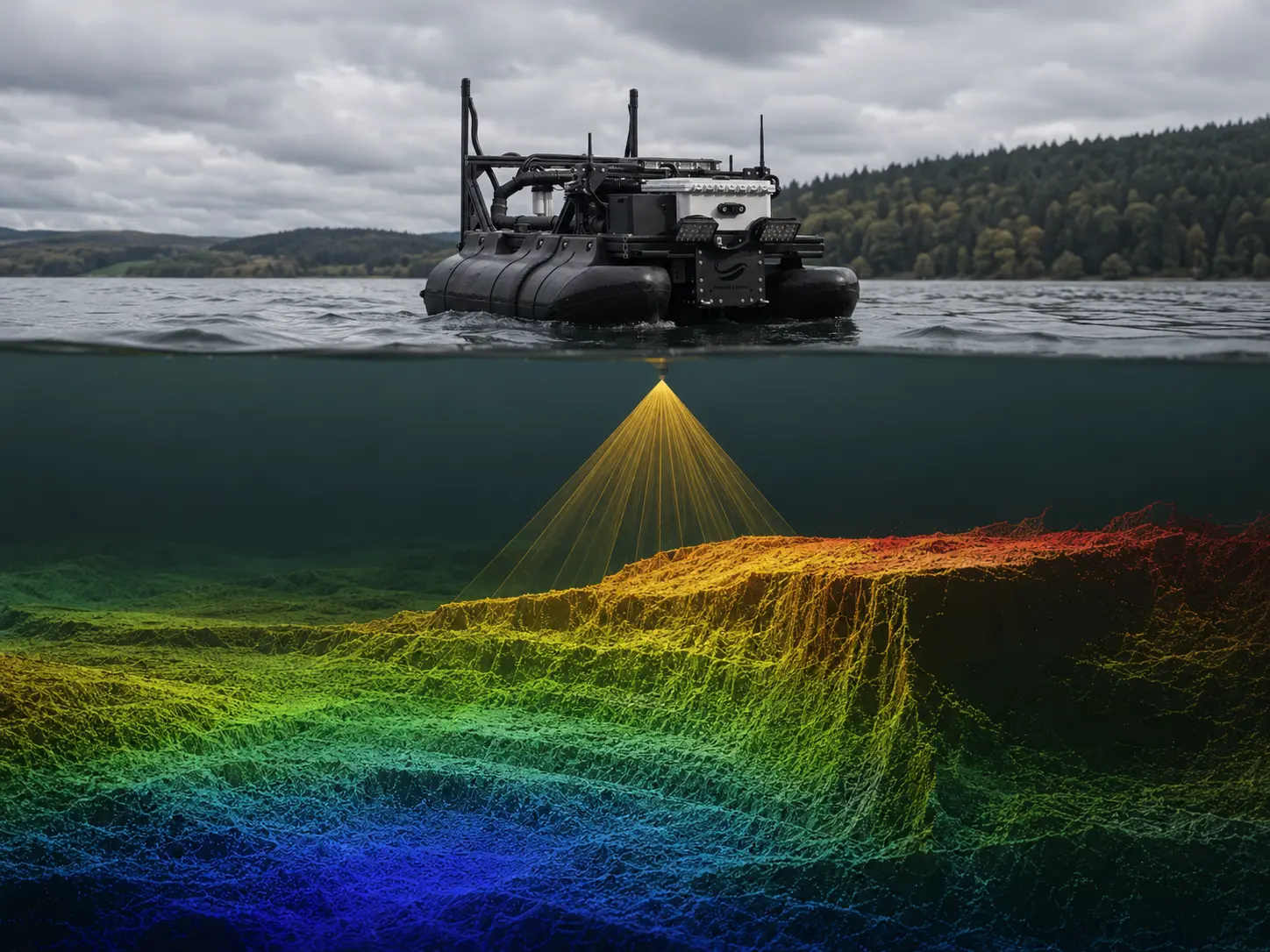
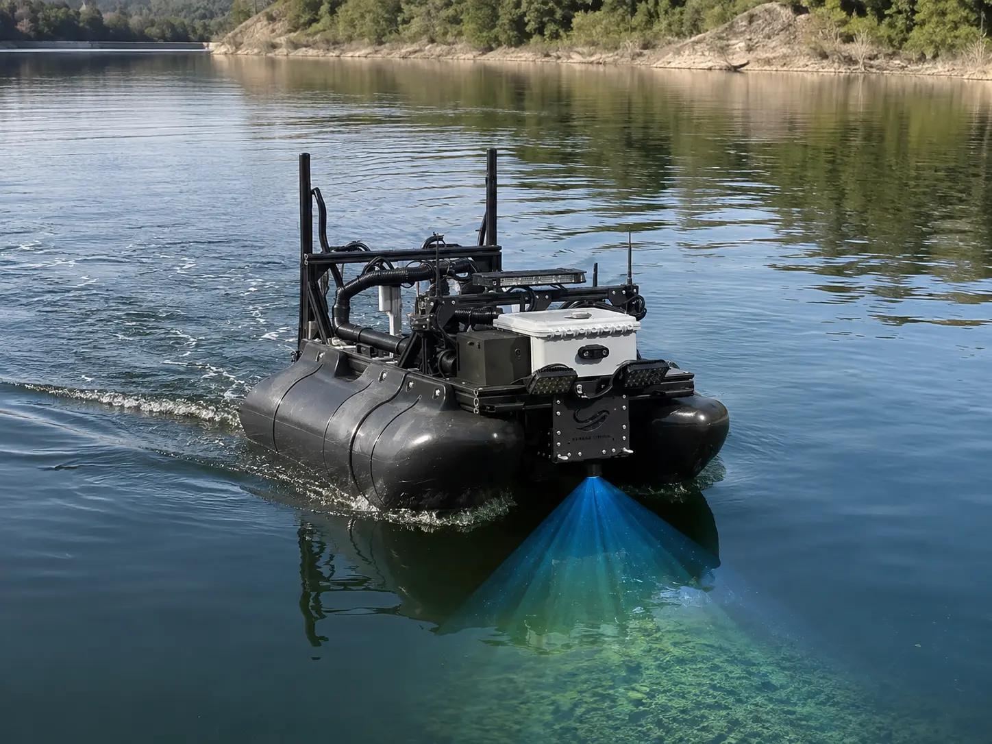
Dual-frequency echo sounders collect continuous depth measurements and help distinguish soft sediment from the underlying hard-bottom response. This supports sediment-thickness mapping, volume calculations, and pre-dredge and post-dredge comparison.
Recorded survey routes can be reproduced during later missions, improving the consistency of sedimentation studies, capacity tracking, scour monitoring, and post-construction verification.
Geolocated soundings support bathymetric surfaces, depth contours, hard-bottom and sediment-layer maps, volume calculations, capacity estimates, and GIS-ready data products.
The platform can be configured with sonar, cameras, water-quality sensors, and other compatible instruments to connect bathymetry with environmental monitoring and asset reconnaissance.
Argus 1.0 is Riparian Systems’ autonomous hydrographic survey vessel, configured, deployed, and supported in California by Sequoia Advanced Systems. The shore-launchable, low-draft platform follows preprogrammed GPS survey lines and carries dual-frequency echo sounders for bathymetric mapping, sediment-thickness analysis, reservoir capacity studies, and defensible pre-dredge and post-dredge baselines. Shore-based supervision allows survey teams to collect dense, repeatable data in shallow, hazardous, and difficult-to-access water without placing personnel aboard the vessel.
The cross-track and repeatability figures describe navigation and track-keeping performance. Final sounding accuracy depends on sonar configuration, calibration, sound-velocity correction, water-level reference, transducer draft, processing, and survey QA/QC. Specifications per Riparian Systems; confirm current configuration for procurement.
Discuss a Hydrographic SurveyArgus 1.0 does not need to replace conventional hydrographic equipment to improve a survey program. Its value often comes from expanding access, increasing coverage consistency, reducing mobilization demands, and collecting repeatable data in portions of a site that are difficult or inefficient for a crewed vessel. The strongest hydrographic programs combine platforms and methods around the required deliverable.
Argus 1.0 maintains planned survey lines across ponds, canals, reservoirs, and confined waterways. It reduces the steering variation associated with manually operated single-beam surveys and creates repeatable routes for future comparison.
A crewed multibeam vessel may remain the appropriate tool for full-bottom coverage, complex harbor work, or high-specification engineering surveys. Argus 1.0 can supplement that effort by surveying shallow margins, restricted zones, and areas where the primary vessel cannot safely or efficiently operate.
RTK topographic survey, aerial photogrammetry, or topo-bathymetric LiDAR can capture exposed banks, flats, and shoreline terrain. Argus 1.0 adds the submerged surface, helping teams build a more complete land-water elevation model.
Bathymetric and dual-frequency data can help identify sediment accumulation patterns and guide the placement of cores, grabs, or other physical samples. The vessel improves sampling strategy even when laboratory or geotechnical analysis remains necessary.
Early bathymetric reconnaissance helps define dredging limits, estimate accumulated material, identify shallow access constraints, and determine where more detailed survey or sampling is required.
Repeatable survey lines and georeferenced surfaces provide a consistent basis for comparing pre-dredge conditions, design elevations, and post-dredge results.
A low-draft, remotely supervised vessel can collect bathymetry near intakes, spillways, culverts, bridge piers, and other submerged assets before divers, construction crews, or larger vessels enter the area.
Recorded routes allow water managers and consultants to return to the same site and collect comparable coverage across seasons or years. This supports reservoir sedimentation studies, scour monitoring, restoration assessment, and watershed planning.
The result is not a choice between autonomous and conventional hydrography. It is a coordinated survey program in which each platform is used where it provides the strongest combination of access, accuracy, coverage, efficiency, and safety. Sequoia Advanced Systems helps organizations determine where Argus 1.0 can strengthen the survey methods, personnel, and equipment they already rely on.
Add autonomous bathymetry, repeatable survey routes, sediment-volume calculations, and GIS-ready deliverables to existing water-resource and engineering services. SEQAV can provide platform, configuration, training, and technical support while the consultant retains the client relationship and professional responsibility for the work.
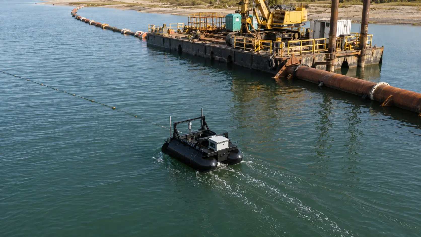
Dredging scopes, payment quantities, and disputes depend on measured volume. Repeatable pre-dredge and post-dredge surveys provide documented surfaces, cleaner quantity comparisons, and stronger proof of completed work.
Reservoirs and ponds lose usable storage as sediment accumulates. Repeatable bathymetric surveys quantify capacity change, support dredging decisions, inform capital planning, and establish long-term records of asset condition.
Reliable channel and reservoir geometry strengthens hydraulic models, sediment-transport analysis, restoration planning, and long-term watershed management. Repeat surveys reveal where a system is aggrading, scouring, or losing capacity.
Bathymetry around dams, spillways, intakes, outfalls, and bridge structures supports reconnaissance, scour monitoring, and asset planning while reducing the need to place personnel aboard a vessel in hazardous water.
Navigable depth must be measured before it can be maintained. Bathymetric survey supports channel maintenance, boat-ramp evaluation, dredge planning, public access, and safe recreational use.
Modern hydrographic survey pairs precise positioning with acoustic depth measurement, and skilled hydrographers with good equipment produce excellent results. A typical program draws on several established methods:
Some small projects still rely on manual probing, lead-line measurements, or sparse depth observations. These approaches can provide preliminary information, but they leave much of the bed surface inferred between widely spaced points.
Autonomous single-beam and dual-frequency survey platforms occupy an important middle ground. They provide denser, georeferenced, repeatable coverage for projects that require more confidence than manual estimates but do not require a large multibeam mobilization.
Define what the survey must produce — a depth model, a sediment volume, a pre-dredge baseline, a change surface — and work back to line plan, sounding density, and the accuracy the deliverable actually requires.
Single- and dual-frequency echo sounders answer different questions, and dual-frequency is what separates soft sediment from hard bottom. Frequency, transducer, and settings should follow the objective.
Survey quality depends as much on position, sound velocity, water level, and draft as on the sonar itself. Uncontrolled, these introduce error no processing fully removes.
Line spacing, overlap, and sounding density determine whether a surface is defensible. Preprogrammed, repeatable lines make coverage consistent and comparable.
Georeferenced surfaces, volume calculations, and defensible records should be a product of the survey, with processing and QA/QC planned from the start rather than reconstructed after the fact.
Autonomy collects dense, consistent soundings; calibration, error assessment, and interpretation remain human work. The platform improves coverage, consistency, and access. Professional judgment determines whether the resulting survey is fit for its intended use.
Depending on the survey, Argus 1.0 can support georeferenced bathymetric surfaces, contoured depth maps, hard-bottom and sediment-thickness maps, sediment volume calculations, reservoir capacity estimates, pre-dredge and post-dredge comparison surfaces, repeat-survey change maps, and GIS-ready datasets.
Two different accuracies matter. Navigation accuracy — how closely the platform holds its planned line — governs coverage consistency and is specified as cross-track error and line repeatability. Depth accuracy is a separate question that depends on sonar selection, calibration, sound-velocity, and water-level corrections. A platform can hold a very precise line and still need proper corrections to produce accurate depths.
Yes. Autonomy collects dense, consistent soundings, but sensor selection, calibration, corrections, error assessment, and interpretation of what the surface means remain the work of an experienced surveyor. The platform improves the data; it does not replace the judgment behind it.
Yes — this is one of its clearest advantages. Shallow-draft, shore-launchable operation reaches shorelines, narrow channels, and hazardous areas near dams, spillways, or intakes that are difficult or unsafe for crewed launches, and it keeps the crew on shore.
Yes, and this is a core advantage of autonomous coverage. Because survey lines are preprogrammed and repeatable, a site can be re-run along the same paths later, making time-series comparison and change or volume calculations far more defensible.
A pre-dredge survey establishes the baseline bed surface and sediment volume before work begins; a post-dredge survey verifies what was removed and confirms design depths. Both are the basis for payment, and both benefit from repeatable, well-documented coverage.
By comparing a measured bed surface against a reference — a design grade, a hard-bottom horizon, or an earlier survey — and integrating the difference across the area. Dense, consistent soundings and a clear soft-versus-hard distinction make the resulting volume defensible rather than an estimate.
At minimum, sound-velocity in the water column, water-level or tide reference, and transducer draft. Uncontrolled, these introduce depth error that no post-processing fully removes, which is why the surveyor’s setup matters as much as the platform.
A single-beam sounder measures depth directly beneath the vessel along survey lines. A multibeam system ensonifies a swath for full-coverage surfaces at higher cost. Dual-frequency refers to using low and high frequencies together so the survey can distinguish soft silt from the hard bottom beneath.
A crewed multibeam vessel may remain the right tool for full-bottom coverage, complex harbor work, or high-specification engineering surveys. Argus 1.0 supplements that effort by surveying shallow margins, restricted zones, and areas where the primary vessel cannot safely or efficiently operate.
Accurate channel and reservoir geometry feeds the hydraulic and sediment-transport models watershed managers rely on. Repeat surveys reveal how a system is aggrading or scouring over time, informing dredging, capacity, and habitat decisions across the watershed.
Hydrographic surveying is the measurement and mapping of the underwater environment — the depth, shape, and often the composition of the bed beneath lakes, reservoirs, rivers, canals, and harbors. Bathymetry, the depth data itself, is the core product.
To calculate sediment volumes and dredging quantities, track reservoir storage and sedimentation, support flood and watershed models, assess scour around infrastructure, maintain navigable depth, and document change over time.
Yes. Sequoia Advanced Systems can provide Argus 1.0, payload configuration, mission-planning support, operator training, deployment assistance, and long-term technical support while the consultant retains the client relationship and responsibility for the professional survey deliverable. Engagement options include platform purchase, a technology partnership, or a SEQAV-supported field deployment.
Begin with the waterbody, project area, required deliverable, target depth range, desired line spacing, accuracy requirements, water-level reference, known hazards, access conditions, timeline, and intended use of the data. These factors determine the appropriate platform, sonar configuration, positioning method, field plan, processing workflow, and QA/QC requirements.
Tell us about the waterbody, required survey deliverable, project area, target accuracy, timeline, and access constraints. Sequoia Advanced Systems will help determine whether an autonomous deployment, technology partnership, or platform purchase is the right next step.
Discuss a Hydrographic Survey